Off Road Running
Overview
During the summer months we venture into the countryside on our Club Run night, once a month. This gives us different perspective of activity, distance and elevation gains / losses. The club has historically organised the Brent Knoll Fell Race each year, in line with the “great outdoor” mind set and varied participation to training and racing. Our members take part throughout the year in organised fell and cross-country races, near and far.
The extended hours of daylight enjoyed in the evenings, allows us the scope to train with a difference rather than pounding the tarmac. Popular off-track runs organised in this period, take in flat beach and river runs, whilst in contrast, hilly runs involve the climbs and descent of Brent Knoll and Brean Down.
Organised off road club runs in more detail:
Brean Down: The club meet at Brean Down and follows a route along the beach before heading up the staircase or ramp to the headland, making it’s way along to Brean Fort. The return stretch follows the footpath before rejoining the beach and cutting through the dunes back to Brean Down Inn. A drink in the pub takes place after the run for some social re-hydration!
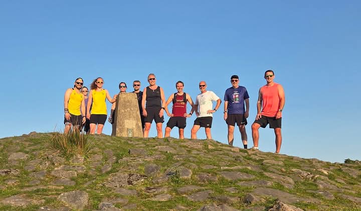
Brent Knoll: The club meet at the village hall car park and run a selection of different routes to the top of the Knoll. These include a route on the pavement alongside the A38 and accessing the Knoll from East Brent, or more commonly past Brent Knoll church, before ascending the Knoll. The downhill stretch emerges in Brent Knoll before another climb over Hill Lane and a return to the cars. Drinks at the Red Cow provides a fine end to this summer run.
Beach runs: Beach runs are tide dependent! A typical club beach run starts from the Bay centre, making its way through Burnham before joining the beach either from the sailing club or via the dunes, where there are several access points. The run’s along Burnham-on-sea’s famous beach provides a unique challenge, building resistance and stamina as well as fine views of the Lighthouse, Severn estuary, Flat holm and Steep holm.
West Huntspill river run: The West Huntspill river run is primarily on roads but has a stretch along the banks of the River Parrett estuary.The run starts from Highbridge Community Hall (a longer run option has been organised starting and finishing from Burnham) and follows the A38 through West Huntspill before taking the service road just after the White Cottage. Running past Laburnum House, the run heads towards the coast and picks up the coastal path heading back towards Highbridge and back to the Community Hall. The run is flat, but has been prone to coastal winds!
Other off-road runs are available and can easily be organised. Just ask!
Become a Member
[/et_pb_text]If you have doubts about joining the club, why not come along to our Tuesday evening club run. The club meet every Tuesday from 6pm onwards at the Bay Area Youth Centre, Cassis Close, Burnham on Sea. Take note that some club runs such as trail or speed sessions do start at other locations in the local area. Check out our Burnham Harriers Facebook page for latest news and updates and when you become a member, access to our Spond app is arranged to follow runs organised during the week.